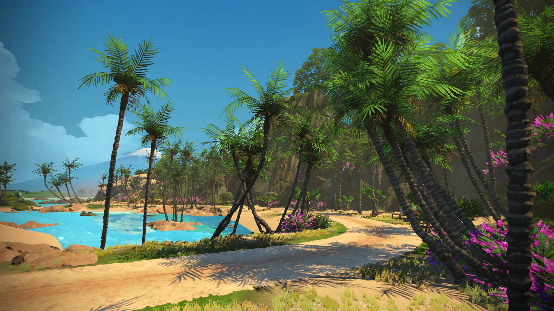
Neues von Zwift: Zwifter können seit letzter Woche die neue "Urukazi" Landkarte befahren, die neueste Erweiterung der Makuri Inseln. Diese umfasst damit über 40 Meilen (ca. 65 Kilometer) an virtuellen Straßen, die auf den Makuri-Inseln erkundet werden können und hier die Radfahrer von Stadtlandschaften aufs Land und nun bis an die Küste führen.
Urukazi (woo-roo-kah-zi) ist eine Kombination aus zwei okinawanischen Wörtern - "uru" bedeutet "Ufer" und "kazi" bedeutet "Brise". Die Kombination der beiden Wörter soll an den ruhigen, unberührten Charakter des südjapanischen Archipels erinnern. Auf den Straßen von Urukazi findest du unsere ‘zwifte’ Interpretation der Landschaft dieser Inseln, während du auf Pflastersteinen, Gravel und einer neuen Art von Untergrund im Zwift-Universum fährst.
Man kann Urukazi direkt durch ein Paddock betreten oder wählen, ob man von Yumezi oder Neokyo aus nach Süden fährt. Die Fahrt von Yumezi nach Urukazi führt durch einen Canyon oder es lässt sich das Höhlensystem von Neokyo erkunden. Eine eindrucksvolle Küstenlinie auf schnellen Schotterstraßen, die direkt am Wasser entlang führen. Ein Härtetest für die Beine, während man die Flora, Fauna und abwechslungsreiche Landschaften der Makuri-Inseln durchquert.
8 neue Routen zur Auswahl:
1. Mech Isle Loop: Kurzer Rundweg durch ein Industriegebiet, Streckenlänge 4 km, Höhenmeter: 38.7m
2. Bridges and Boardwalks: Die größte Insel in Urukazi, Streckenlänge 6.3 km, Höhenmeter: 59.5m
3. Island Hopper: Alle Inseln von Urukazi in einer einzigen Runde, Streckenlänge 18 km, Höhenmeter: 128.5m
4. Fine and Sandy: Mangroven und Sandstrände auf Road-Runde, Streckenlänge 10.6 km, Höhenmeter: 77.1 m
5. Island Outskirts: Ein Rennen um die Außenbezirke von Urukazi, Streckenlänge 11.3 km, Höhenmeter: 90.1 m
6. Makuri 40: “Feel the burn” auf dieser 40 km langen Schleife um Makuri, Streckenlänge 40 km, Höhenmeter: 306.6 m
7. Country to Coastal: Fahrt von freien Feldern zum Ozean, Streckenlänge: 33.4 km, Höhenmeter: 274 m
8. Turf N Surf: Ein Rennen von den Straßen der Stadt zu den Sandstränden, Streckenlänge: 24.6 km, Höhenmeter: 195.8 m

